The Regional Municipality of Wood Buffalo is located within Treaty 8 Territory, and home to six First Nations and six Métis Communities, all with very distinct, diverse, and rich histories.
Please join us on this journey of discovery. Let's start in the North and work our way south.
Fort Fitzgerald
The most Northern community in the region is Fort Fitzgerald, located on the Alberta and Northwest Territories border and nestled on the banks of Slave River. It is home to Smith’s Landing First Nation and about 493 kilometers north of Fort McMurray.
From Fort McMurray, head north to Fort Chipewyan on the winter road. This journey takes you on 265 kilometers of frozen Athabasca Delta. As you head further north, visit the Boreal Forest, which is home to 150 bird species and Woodland Caribou. Characterized by its diverse animal and plant species, lakes and wetland, take in a true northern experience in all its natural beauty.
Traveling 228 kilometers further north from Fort Chipewyan, make sure to visit Fort Smith, NWT. 15 kilometers before Fort Smith is where you’ll find Smith’s Landing First Nation Reserve, Thebacha Nare (also known as border town). Smiths Landing First Nation has 354 members, the majority of whom live in Fort Smith. Not too far away you’ll find Fort Fitzgerald reserve, which is one of the 10 reserves located 25 kilometers south of the Alberta and NWT border. 12 people live in Fort Fitzgerald, and 58 live in Thebacha Nare, or border town there are also 5 residents that live halfway between Thebacha Nare and Fort Fitzgerald. Residents of Fort Fitzgerald travel to Fort Smith to shop or attend school, as there are no supporting services, except electricity. Even phone services were non-existent until 2003. Residents seeking employment opportunities outside of hunting and trapping must also travel to Fort Smith.
If you’re feeling adventurous, and depending on the season, travel from Fort McMurray on the river system by dog team, skidoo, or boat along the Athabasca River to the Fletcher Channel and along the Embarras River. Once you arrive at Athabasca river, cross into Fort Chipewyan, and go another 160 kilometers north on Quartre Fouche River along the Peace and Slave Rivers - and finally to Fort Fitzgerald. Situated at the beginning of four sets of impossible rapids, Fort Fitzgerald was once a major portage point for barges transporting goods to Fort Smith and the north.
First Nations
Smith's Landing First Nation |
Smith's Landing First Nation is a Northern Alberta Band, just south of Fort Smith, NT with a location about 2 kilometres away on the other side of the Albert Border in Treaty 8 Territory. With 354 members, the Chief and Council, consisting of 1 Chief and 4 Councillors who are elected officials. The Chief and Council are directly accountable to the membership for the overall success of the band, while pursuing the mission statement of Smith's Landing First Nation. They also provide leadership and direction, govern the operations, create laws, and oversee the activities of the administration to ensure that the programs and services are delivered to the membership in a fair, equitable and efficient manner. The administrative lead is the Chief Financial Officer who reports to the Chief and Council. There are 14 staff members. The Treaty Land Entitlement was signed on May 6, 2000. It officially lay claim to its 10 reserves -
The Mission Statement of Smith's Landing First Nation is "We, the Thebati Dene Suline, have been sovereign since time immemorial. Together, we will continue our journey in harmony with the environment to sustain a healthy and self-sufficient lifestyle for future generations. To honour our Creator and ancestors, we will protect and nurture the integrity of our Dene Ch’anie." Smith’s Landing First Nation people speak the beautiful Dene language, love to practice their Traditional ways, and are great stewards of the land.
|
Fort Chipewyan - The oldest settlement in Alberta
Nestled on the northwest shore of Lake Athabasca, the eighth largest freshwater lake in Canada, Fort Chipewyan is the oldest settlement in Alberta and one the Regional Municipality of Wood Buffalo’s most northern communities.
Fort Chipewyan lies 265 kilometers north of Fort McMurray. Isolated by nature, Fort Chipewyan is only accessible by plane, boat, or canoe in the summer and by skidoo, dog team, or vehicle on the Winter Road in the winter months (December to March - weather permitting). While winter weather conditions can be quite cold , to see Fort Chipewyan’s majestic beauty and the natural landscape of the Canadian shield during this season makes the trip worthwhile and is highly recommended.
Paddling a canoe or traveling by boat in the summer months, or by skidoo in the winter, you begin your trip to Fort Chipewyan at the Snye on the Clearwater River, heading north. From there, travel along the mighty Athabasca River and on to the beautiful Fletcher Channel. You will then come to the Embarrass River, bringing you to Lake Athabasca, where you go northwest and cross the lake into Fort Chipewyan.
In wintertime, with a team of sled dogs, you depart from the Snye, head north on the Clearwater River on to the Athabasca River. You’ll pass many traplines along the way as you travel the Embarrass River to Cree Creek and across Lake Mamawi. Once there, connect to the Quartre Fouche River, bringing you to the west end of Lake Athabasca, then cross the lake and enter Fort Chipewyan for a good visit and a warm welcome!
By vehicle on the Winter Road during the winter months, you head north on Highway 63, past the turn off to Fort McKay and over the famous “Bridge to nowhere.’’ It really does go somewhere in the winter months - to Fort Chipewyan and Fort Fitzgerald! Stayon the winter trail, follow the signs straight to Fort Chipewyan, and you’re there. Congratulations you made it - all 265 kilometers on this beautiful frosty trail!
All three of these routes take you through beautiful Wood Buffalo National Park, a UNESCO (United Nations Educational, Scientific, and Cultural Organization) World Heritage site famed for its huge tracts of boreal forest and the world’s largest herd of wood bison.
Flying in is the only way to access Fort Chipewyan during spring break up and winter freeze up. Luckily, flights are available year-round.
Established as a trading post in 1788 by the Northwest Trading Company, Fort Chipewyan was named after the Chipewyan people (Athabasca Chipewyan First Nation) who first lived in the area. More than 230 years later, trapping, hunting, and fishing are still activities enjoyed by Fort Chipewyan residents.
Residents are Athabasca Chipewyan First Nation (dene suline), Mikisew Cree First Nation, and Fort Chipewyan Métis descent, who speak the beautiful Dene and Cree traditional languages. Several community Elders are fluent in both traditional languages. In Fort Chipewyan, the three community groups support each other and work to keep traditional values and the Dene and Cree languages alive and thriving.
First Nations and Métis Communities
Athabasca Chipewyan First Nation |
Dene language
Dene Laws |
Mikisew Cree First Nation |
The Mikisew Cree First Nation (Mikisew) has lived on the ancestral lands of the Athabasca Delta and Wood Buffalo National Park in northeastern Alberta since time immemorial. The lives of our members are linked to the land and to a close understanding of traditions, history and a natural way of life. Many of our members live in the hamlet of Fort Chipewyan, and our traditional lands range over a large portion of Athabasca oil sands deposits. 
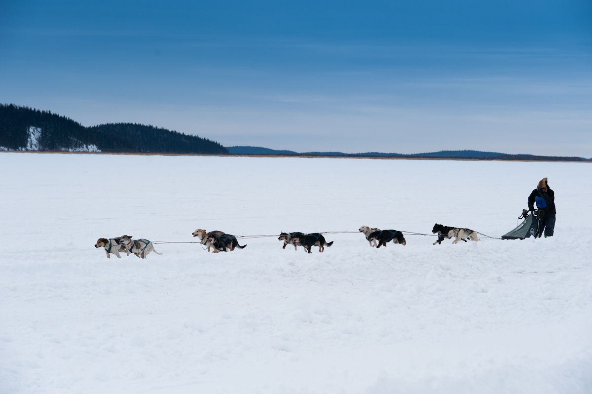
Lake Athabasca, the eighth largest natural lake in Canada, flows through Wood Buffalo National Park on its way down the Mackenzie River and to the Arctic. The Athabasca Delta, which is at the centre of Mikisew’s traditional lands, is a unique and cherished international ecosystem that sustains us. When the fur trade came west and established a trading fort in this area, the Mikisew Cree were among those who traded furs. 
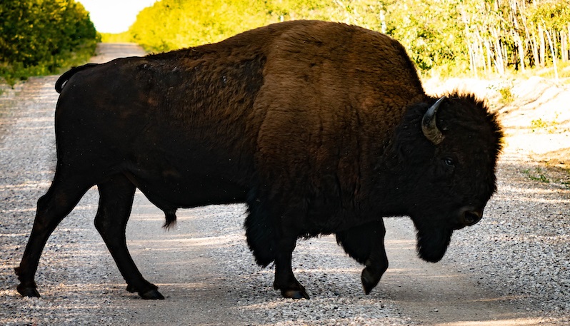
Mikisew lands are in the Tazin Lake Upland ecoregion, extending north of Lake Athabasca, as well as the Athabasca Plain ecoregion. The Tazin Lake region is rugged and, in some areas, has soil that is frozen year-round. This ecoregion, full of trembling aspen, balsam poplar, white spruce, balsam fir, and other species; has many small lakes and streams that eventually flow into Great Slave Lake. Here you can see black bear, moose, wolf, woodland caribou, beaver, muskrat, snowshoe hare, and spruce grouse. The Athabasca Plain ecoregion stretches south from Lake Athabasca, and features bedrock, sand dunes and wetlands that support stands of jack pine, paper birch, white spruce, black spruce, balsam fir and trembling aspen. Wildlife here includes moose, black bear, woodland caribou, lynx, wolf, beaver, muskrat, snowshoe hare, and many birds such as geese, pelicans and grouse Mikisew is governed by an elected team of representatives consisting of one Chief and six councilors. This team works diligently locally, nationally, and internationally, to preserve history and tradition while propelling progress. Chief and council provide guidance and direction to our executive committee which manages the day-to-day operations of the Nation, providing services, allocating resources, and advocacy for Band members and their interests. The Mikisew Cree have 2800 members with Most members living in Fort McMurray, Edmonton, Fort Smith, the Northwest Territories and Fort Chipewyan. Mikisew Cree speaks the woodland Cree dialect with an active plan on revitalizing their language. The Mikisew Cree have 9 reserves surrounding Fort Chipewyan,
In honor of Chief Mikisew (Justin Marten), the first Chief signatory to the Treaty 8 adhesion on July 13, 1899, the “Cree Indian Band” was re-named the “Mikisew Cree First Nation” in 1991 as we sought our own autonomy. We wanted a name that was meaningful and honorable to show appreciation and to pay our respects to the late Chief Mikisew. Mikisew was Chief Justin Martens traditional name. Mikisew means Eagle in the Cree Language. In 1899, the Mikisew Cree First Nation was an adhesion signatory with Canada to Treaty 8. In 1986, Mikisew signed a Treaty Land Entitlement that created several reserves in and around the Fort Chipewyan area and into the area north of Lake Athabasca.
The Significance of the Eagle with Mikisew Cree logo The eagle is an important element of the Mikisew logo. It is highly regarded by members as strong and powerful, and signifies love and virtue the Eagle is said to carry our prayers to the creator as it is the bird that flies the highest. Seven Sacred Teachings |
Fort Chipewyan Metis Association |
The Fort Chipewyan Metis Association has a long and great history in the area of Fort Chipewyan dating back to 1788. Fort Chipewyan Metis has a membership of 130 plus members. Fort Chipewyan Métis Local 125 (“Fort Chip Métis”) is the organization of the Métis people who live in Fort Chipewyan, AB. The association is a basis for the preservation of Métis lifestyles and culture. The Métis have been an integral part of history in the Athabasca region of Northern Alberta since the early 1800s. Today, that has not changed. The Métis ways of living help to guide FCMA members into the future. Our ancestors taught us fishing, hunting, and how to live in a way that preserves the land. We remember them and the knowledge they brought forth. It is important to strengthen and share these ways of knowing. Through our elders—the gatekeepers of our wisdom and knowledge—and others in our community so our association continues to thrive. The Métis people have a strong oral history of using bitumen and tree bark to create, tools, goods for trade and roofing for homes building skiffs to travel the river systems while out on the land, these are just a few examples of the Metis ingenuity. The Métis are proud of their history of trapping for substance and know the land so well round Fort Chipewyan. The Fort Chipewyan Métis continue to be harvesters and travel the waters around Fort Chipewyan on skiffs built traditionally by Metis members. The Fort Chipewyan Métis are an important piece of our region and have been here since before Canada was a country.- The Metis continue to exercise their hunting and trapping rights in their traditional territory, they are a great community partner and stewards of the lands. |
Fort McKay
Fort McKay is a community that is rich with culture and traditions located 60 kilometers north of Fort McMurray at the confluence of the Athabasca (west bank) and MacKay rivers, setting the scene for a very magnificent community.
Fort McKay is well known for its connection to culture hosting many community events such as Treaty days, Traditional Pow wows and Métis days always with a warm welcome to visitors to their community.
Residents have a strong connection to the land and are avid land users and stewards.
Fort McKay can be accessed from Highway 63 year-round or an airstrip located in Mildred Lake, three kilometers south. If we were traveling to Fort McKay in the winter months when the river is frozen by dog team or ski-doo or in summer months by canoe or Boat using the river system you would leave Fort McMurray from the Snye onto the Clearwater River heading north then merge on to the Athabasca River heading north as well which would take you all the way to beautiful Fort McKay.
Fort McKay was established in 1820 by the Hudson Bay Company as a trading post but was not known as Fort McKay until it was named after Dr. Williams Morrison McKay in 1917. While the oil sands industry is the primary employer in Fort McKay, forestry, hunting, and trapping remain to be a part of the local economy.
Fort McKay is home to Fort McKay First Nation and Fort McKay Métis Nation two traditional languages spoken in Fort McKay are Cree and Dene
First Nations and Métis Communities
Fort McKay First Nation |
In addition to the Fort McKay community, Fort McKay First Nation has reserves 174A at Gardiner (Moose) Lake and 174B at Namur (Buffalo) Lake, approximately 65 kilometres northwest of Fort McKay. Moose Lake is the traditional home of what is now the Fort McKay First Nation. After hearing stories of neglect and abuse from the families of Indigenous children taken to attend residential schools, Cree and Dene families persuaded the Indian agent to build a day school at the Fort McKay fur trading post. Families then moved from Moose Lake to form a community that would enable their children to return home each night. Though this compromise meant children could remain at home, the move didn’t happen without personal and cultural losses. Some children had already been taken to residential schools. Some members who came later to live in Fort McKay attended residential schools. And some never came home. Moose Lake is a culturally significant area for Fort McKay First Nation, and the Nation worked with multiple governments over two decades to develop a Moose Lake Access Management Plan as an important step towards the protection of Moose Lake and the Nation’s constitutionally recognized and affirmed s.35 Treaty rights. This plan was approved in February 2021. A signatory to Treaty 8, Fort McKay First Nation’s mission is to assert Treaty rights, revitalize culture and language, promote education, build economic capacity, and support wellness to create opportunities for our Nation’s healthy and sustainable future. Fort McKay First Nation takes a balanced approach to resource development and is a relationship builder. Revenue generated from Impact Benefit Agreements with oil sands developers and Nation-owned businesses (established in 1986) are invested in community infrastructure, programs, and services to benefit all members. Focusing on business diversification, Fort McKay First Nation is working towards its vision of a healthy and sovereign Nation enjoying culture, educational, employment, and economic successes. |
Fort McKay Métis Nation |
The Fort McKay Métis Community comprises the historic Métis community that initially provided labour to the fur trade in the Athabasca region of northeastern Alberta in the early nineteenth century. While the fur trade has remained a core part of the community’s identity, in more recent years, members have had to manage the impacts and leverage opportunities brought by the development of the oil sands. Its members have a mixed ancestry that includes French, English, Cree, Dene and Métis heritage with close ties to Fort McKay First Nation members. The Fort McKay Métis Community draws strength from the positive aspects of their mixed heritage, keeping feet in both the Aboriginal and Euro-Canadian backgrounds. Community members are still very active in hunting, fishing and gathering food. The community has a long history of keeping our culture alive by ensuring our young generation has access to stories, traditions and lessons by our trusted knowledge keepers and Elders. Historically, the Fort McKay Indigenous community followed the conventions found in many northern communities engaged in the fur trade, organizing themselves in small kinship-based groups that made decisions primarily through consensus. The groups were fluid and mobile, covering a sizeable traditional territory and often speaking multiple languages. Community members would follow their standard rounds in close connection with the natural world, which they depended upon for all aspects of their life. In the past 10 years, the Fort McKay Métis Nation has seen substantial growth thanks to the strong relationship between the community members and the governance team. In 2018, the Fort McKay Métis Nation saw a significant milestone when they bought, fee simple, the land on which their community is built. This was historical and an example to many other Métis communities. A founding member of the Alberta Métis Federation, The McKay Métis Nation is committed to self-governance. On May 24, 2019, unveiled a constitution and other governance instruments including an Election Act, Governance Act, and Membership Act. The McKay Metis Group (MMG) is a group of companies dedicated to providing high-quality service in many areas such as civil construction, security, rig moving, site amenities, industrial solutions, crane services, transportation, specialty, and commodity chemicals. In addition, the MMG funds the Fort McKay beautification program, built parks, provided affordable housing, granted post-secondary scholarships for community members, and invests in local infrastructure. |
Nistawâyâw (Cree)Ełídlį Kuę́ (Dene) Where Three Rivers Meet Fort McMurray
Nestled in a boreal forest valley where the Athabasca and Clearwater and Hangingstone Rivers meet is Wood Buffalo's urban center, the community of Fort McMurray. Originally established as a Hudson's Bay Company trading post in 1870 prior to this Fort McMurray was a visiting stop and gathering place for the First Nations that lived, hunted, trapped, and traveled through the region.
Today, Fort McMurray is a community filled with natural beauty from the boreal forest to the majestic sparkling rivers that run through our community. Fort McMurray is such a caring and supportive community, and we are known for the strength we have showed through the last decade. Fort McMurray is rich with culture as we have a lot of residents who have come from the First Nation and Métis communities from our region and across the country which makes this a great hub for all of our rural communities. Fort McMurray draws attention from around the world as the residential and commercial focal point of Canada's oil sands industry and has a great amount of Indigenous business who continue to grow and flourish and positive impact the community through social and economic growth.
Nistawâyâw (Cree) Ełídlį Kuę́ (Dene)( Fort McMurray) is home to the office of the Athabasca Tribal Council and the Nistawoyou Association Friendship Centre.
Métis Communities
McMurray Métis |
When Henry Moberly arrived to build the Hudson’s Bay Company (HBC) Post in 1870, which he named after Fort Chipewyan Chief Factor William McMurray who was Métis. The Métis McDonald family from the Red River Colony in Manitoba became the first permanent settlers on what is now known as MacDonald Island, the site of McMurray Métis’ Cultural Centre. Other Métis families soon joined the McDonalds in settling Fort McMurray. These early Métis families owned much of the land surveyed in the early 1910s and the Métis were crucial in building the first school. The Métis trapped along the rivers in the winters, developed key early industries, including the sawmills, captained the steamships, and worked the docks and railways. Métis families that continued to live on their traplines would stay at Moccasin Flats in the summer and work on the boats, where some Métis families eventually settled over time. The mixed economy of the McMurray Métis was embedded in strong bonds of family and community, where traditional knowledge and values were passed from one generation to the next. The Churches anchored the social and spiritual life of the community. There was a clear sense of Métis identity and pride. The Cree language remained common, and weekends were filled with traditional Métis fiddle music and jigging, whether in family homes or dance halls. As industry grew in the first half of the twentieth century, more and more Métis families settled in Fort McMurray. The onset of large-scale oil sands extraction from the 1960s would transform this small Métis town of 1,100 people into the rapidly growing city. Despite the displacement caused by oil sands mining and a population boom, the Métis of Fort McMurray continued to balance their traditional activities and culture, including hunting, fishing, and trapping, with participation in the growing oil and gas sector. The Métis played a central role in the creation of the Nistawoyou Association Friendship Centre in 1964 and Fort McMurray Métis Local 1935 (McMurray Métis) was founded in 1987 to protect and advance the rights and interests of the Métis. Today McMurray Métis represents a thriving and vibrant Métis community in Fort McMurray with over 750 members. Looking to the future but anchored in our past, we partner with the governments, industry, compatible businesses, First Nations, schools, and community organizations to strengthen our Métis presence, educate our youth and future leaders, and build a Fort McMurray based on respect, collaboration, and shared prosperity. |
Centres and Organizations
Athabasca Tribal Council |
ATC is a strong community partner sharing culture, traditions and Indigenous ways of knowing with the broader community and region. It provides an overall Indigenous lens within our community creating a great sense of pride within the First Nations. ATC also has hosted a phenomenally successful Cultural Festival that was well attended in the urban area as well as organized many wonderful community events welcoming all urban residents. ATC is made up of a Board of Directors, a CEO who oversees 6 active departments and 30+ employees in 3 locations. ATC’s main office is in Fort McMurray, with local Child & Family Services offices in Edmonton and Fort Chipewyan. |
Nistawoyou Association Friendship Centre (NAFC) |
|
Mark Amy Treatment Centre |
The original people of Willow Lake followed the calls of the loons to find themselves on its shore. They knew they would find water, sustenance, and a place to rest their weary bodies after a long journey. It was a place for healing. The Mark Amy Treatment Centre, a part of the Wood Buffalo Wellness Society, is located on Willow Lake. As reflective as its waters, it is also a place for people to find comfort, rest, and healing after a long a journey. The society offers sought-after mental health and addictions treatment programs that support all parts of the being. The programs are trauma-informed and connect participants with Indigenous cultural-based teachings. “Our programs aim to address the intergenerational effects of colonization,” says Jo-Anne Packham, Executive Director of Wood Buffalo Wellness Society, “We are in the business of breaking cycles.” |
Keyano College |
Established 1966
In Bush Cree, the word kiyânaw refers to the collective nature of we and us, a nod to our togetherness. In Indigenous and non-Indigenous cultures alike, our success is derived of foundational community. Originally called the Alberta Vocational Training Centre, the institution revisited the goals of its programs and services and reopened in 1975 under the name Keyano College. The name would reflect the needs of our community and the collective learning and growing together. The logo – ‘Yours, Mine, Ours’ – embodies the spirit of kiyânaw. Keyano College currently operates several campuses, as well as learning centres in the communities of Willow (Gregoire) Lake, Fort McKay, and Fort Chipewyan. The institution prides itself as a community builder by offering the training and skills to support the needs of our region. |
Anzac / Willow Lake
The scenic hamlet of Anzac is on the western shore of Willow Lake (Gregoire Lake) in the southern region of the Municipality and is near Gregoire Lake Provincial Park. Located approximately 45 kilometres southeast of Fort McMurray, Anzac can be accessed from Highways 63 and 881.
Originally known as Willow Lake, when the settlers mapped out the region they changed the lake's name to Gregoire Lake after a elderly man with the last name Gregoire who lived on the island in the middle of the lake. The lake's name has recently reverted back to Willow Lake.
Back in the day (1917), there was a passenger train that road through Anzac taking residents to the Fort McMurray. Anzac was a stopping point on the Alberta Great Waterways Railway Line.
If you were traveling by skidoo or dog team in the winter months you would take the rail road tracks north from Anzac , down the cutline to Saprae Creek/Clearwater Reserve area then on down to the old waterways road and wala! You are now in Waterways! This is a famous trail for skidooers to travel to anzac for one of the delicious burgers!!
The community was originally named Willow Lake but was renamed to Anzac in 1917 as a stopping point on the Alberta Great Waterways Railway Line. The name Anzac is after the Australia and New Zealand Army Corps.
Willow lake is a great quick escape for the urban residents to get to enjoy the beauty of nature.
According to the 2018 census, there are 659 residents currently living in Anzac. The Anzac surrounding area is also home to Fort McMurray First Nation and the Willow Lake Métis. Community services include a volunteer fire department, a community meeting hall, several outdoor recreational facilities and the Anzac Community School.
First Nations and Métis Communities
Fort McMurray 468 First Nation (FMFN468) |
Fort McMurray 468 First Nation (FMFN468) is a Cree band located 38.4 kilometres from Fort McMurray, Alberta. They can trace their ancestry to the Woodland, Plains Cree, Chipewyan, and Beaver people of Alberta. The Nation signed adhesion to Treaty 8 in 1899. Fort McMurray 468 First Nation was a part of the same band as Fort McKay First Nation until separating in 1942. The Nation is also a member of the Athabasca Tribal Council (ATC), which represents five First Nation bands in northeast Alberta. Fort McMurray 468 First Nation is made up of four reserves about 31 km2, including:
Reserves 176, 176A, and 176B are located near Anzac on Gregoire Lake (Willow Lake) approximately 38.4 km southeast of Fort McMurray. |
Willow Lake Métis Nation |
The historical Willow Lake community was close to trade and travel routes that connected Fort McMurray and Willow Lake to Lac La Loche to the east, to Fort Chipewyan to the north, and to Lac La Biche to the south. Willow Lake Métis people lived on and derived their livelihood from the lands between these locations through much of the later fur trade period, and WLMN people continue to use these lands to exercise their Indigenous rights, sustain their culture and identity as Métis people, support their community, and pass their knowledge and way of life on to their descendants. Key Métis family lines represented in the WLMN community include Bourque, Cardinal, Huppie, Lavallee, McKenzie, Quintal, and Whitford. Willow Lake families have origins in the vicinity of Willow Lake, Cheecham, and Fort McMurray as far back as memory and oral history extends. Members and their ancestors have a history in the region dating back at least two hundred years. In the 1920s, ancestors of some current Willow Lake families were moving into the area to trap and to work on the rail line. Lawrence and Pete Whitford came into the area in the 1920s; George Lavallee came into the area from Lac La Biche and members of the Bourque family came into the area with work on the rail line in the 1950s and settled at Anzac in the 1960s. Many of the personal histories of present-day WLMN members reflect the history of northern Alberta (including the Lac La Biche and Fort McMurray regions) and Métis culture and connection to the land. Cultural practices that characterized Métis communities in northeastern Alberta before European control included living off the land by hunting, trapping, fishing and plant gathering, supplemented with varying degrees of wage labour. Many present-day WLMN members were taught harvesting skills by parents and grandparents who were highly experienced in hunting, trapping, fishing, and plant gathering. These cultural practices continue to be taught on traplines that have been in their families for several generations. WLMN members also value traditional practices that continue to characterize the community, such as sharing food and labour, caring for Elders, and gathering to feast and dance and tell stories. These traditional cultural practices continue to connect them as a Métis community today. The WLMN community are connected through kinship, economic interests, and political ties with surrounding First Nations and Métis communities in northeastern Alberta. |
Chard (Janvier South)
Situated on the shores of Bohn Lake, the hamlet of Janvier is in the southern region of the Regional Municipality of Wood Buffalo. It is approximately 120 km south of Fort McMurray and can be accessed from Alberta Highways 881 as well as from a small airstrip located in the community. There is a large Métis population in Janvier, and it is home to the Chipewyan Prairie First Nation.
Janvier is located on the banks of Bohn Lake. Travelers going to Fort McMurray would portage, or if the water was high, could paddle into the Christina River then on to the Clearwater River. That would take you right into Fort McMurray. Transportation modes have always been plentiful for the people of Janvier, as dog teams, horses, and an ice road made the trip into Fort McMurray quick in winter. During the summer months, another shorter road was utilized by horse and buggy and the waterways
The community’s assets and supports include the Janvier Dene Wood Buffalo Community Association, the Sekewha Youth Centre, and a volunteer fire department.
Chard is more commonly known and referred to as Janvier in the Regional Municipality of Wood Buffalo and by its residents, and alternately known as Chard. The name Chard is after A. Chard, a transportation official.
Janvier (Chard) is located 6 kilometers (3.7 mi) northeast of Highway 881, approximately 94 kilometers (58 mi) southeast of Fort McMurray and 45 kilometers (28 mi) west of the Saskatchewan border.
The population of Janvier in 2012 was 171 according to Regional Municipality of Wood Buffalo’s Municipal Census that year.
First Nations and Métis communities
Chipewyan Prairie First Nation |
Since time immemorial to the present day, the members and ancestors of Chipewyan Prairie First Nation have derived their livelihood, culture and identity from hunting and gathering throughout their traditional lands (No Ha' Nene) that radiate outward from the Christina River watershed. The administrative base for the Nation is located on reserve Janvier 194, which is located immediately contiguous to the off-reserve hamlet of Janvier, which is administered by the Regional Municipality of Wood Buffalo. Comprising members of Chipewyan Prairie First Nation and non-status Métis families and individuals residing within the hamlet of Janvier, the community of Janvier (the 'Community') is situated in northeastern Alberta adjecent to Bohn Lake. All weather secondary Highway 881 connects the hamlet of Janvier and the main settlement on Janvier Reserve 194 to the urban centres of Fort McMurray and Lac La Biche. A Chief and three Councillors, who are elected under a custom electoral system, govern Chipewyan Prairie First Nation. Chief and Council engage the Nation's Elders and community members on matters that affect the Community as a whole. While the Nation is a member of the Athabasca Tribal Council (ATC) and the Treaty 8 First Nations of Alberta, neither organization is authorized to consult on behalf of the Nation on matters that affect Chipewyan Prairie First Nation Treaty and Aboriginal rights. |
Chard Métis Nation |
The Chard Métis Nation community is 120 kms south of Fort McMurray along highway 881 in the Hamlet of Janvier and borders Chipewyan Prairie First Nation. The Chard Métis’s history dates back for multiple generations and can be traced from the early 1800’s. Our community and its members have a very close connection with the land and our Dene ancestors, the majority of our members still live subsistence lifestyles and speak our Dene language. Our founding families can be traced back to Lac La Loche, Cold Lake, Garson Lake and Green Lake. Our people have survived for many years from what our land would provide for us, that is why we try to honour and care for it as much as we can while passing this knowledge and culture on to the next generations. We are very proud of where we have come from and more importantly where we are going. Our mission is to preserve and promote the Métis way of life, by looking to our elders, to maintain our Métis traditions, culture, spirituality and respect of Mother Earth. We are striving to ensure future generations carry on this mission, we are dedicated to educating and empowering our youth. |
Conklin
Conklin is the most southern rural hamlet in the Regional Municipality of Wood Buffalo. The community is situated approximately 155 kilometers southeast of Fort McMurray and consists primarily of Metis people who can trace their history to the late nineteenth century. Conklin is a recognized as a Métis Harvesting Community in the Government of Alberta Métis Harvesting Policy and continues to actively promote its unique Metis culture through organizations such as the Conklin Métis Local # 163 and Conklin Community Association.
Many generations of the community founders live in Conklin and their roots can be traced back to when Conklin was known as Nakewin. Nakewin, a Cree word which means a “stopping place” and where resources are plentiful.
The hamlet of Conklin was originally situated at the extreme northwestern end of Christina Lake, adjacent to its outlet at the Jackfish River. When the Alberta and Great Waterways Railway (which eventually became part of the Northern Alberta Railway and later the Athabasca Northern Railway) reached Conklin in 1921, the town was relocated alongside the railway tracks.
Conklin was an important centre for the local fur trade from 1940 to 1960. Mink pelts from several mink farms in the area were transferred by canoe and dogsled to the railway siding at Conklin for shipment to markets.
From 1940 to 1960 there was heavy commercial fishing in Christina Lake, and a fish processing plant was located at the outlet to the Jackfish River.
Métis communities
Conklin Métis Local |
Métis people have been living in and around Christina Lake for many generations, with evidence that ancestors of the current Conklin Métis community lived there since at least the mid-nineteenth century. Conklin is a Métis community that was established in 1916 named after a time keeper who was a contractor for the railway, John Conklin.The community historically maintained a large harvesting area, extending north of Fort McMurray, south of Lac La Biche, east to the Saskatchewan border and west to the Athabasca River. This harvesting area has remained largely stable into the twenty-first century, even with industrial development making it more difficult for community members to harvest in the same ways they did traditionally. as you could roughly travel 30-50 miles in a day via dog team). Since the early 1920s, the railroad became the primary means of transportation for the community. In 1973 the Conklin Minstrels recorded an LP where the “Muskeg Special” features prominently. You can hear the songs on SoundCloud. Christina Lake Recreation Resort is a popular destination for many visitors and residents of Conklin. |